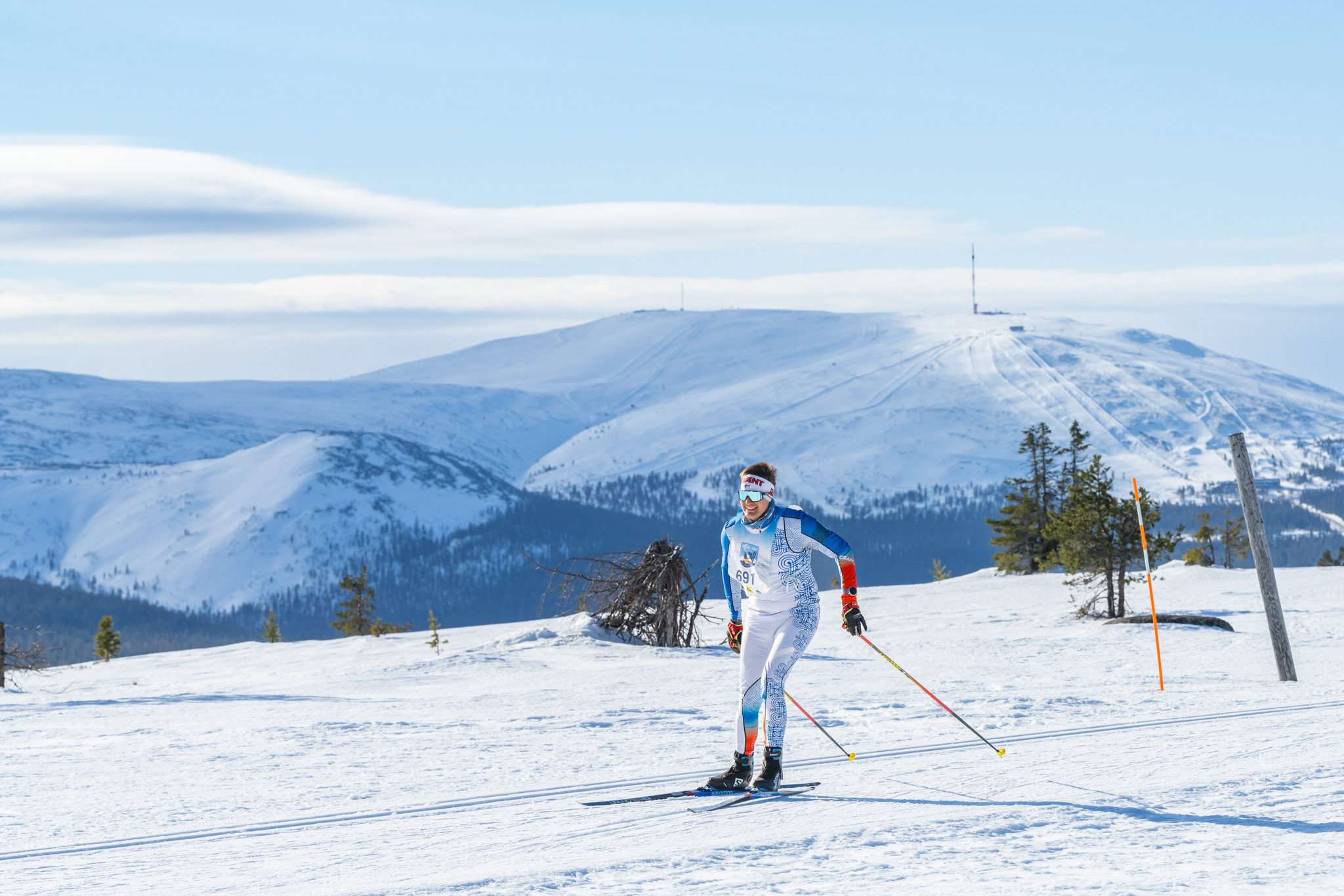
Route
70km
The course of about 70 kilometres runs from Ylläsjärvi, through Äkäslompolo, Kukastunturi and Pyhäjärvi to Levi. Along the route, three fells (Kellostapuli, Kukastunturi and Pyhätunturi) are crossed.
55km
The 55km route excludes the initial part (Kellostapuli Gorge) of the longer route and starts from Äkäslompolo. Besides, the last Pyhätunturi fell is not climbed, but passed on its right side. There are five service stations.
Service stations
| Service | KM 70 / 55 |
|---|---|
| Ihmisen Rinki | 9 |
| Äkäslompolo | 15 |
| Jollos – Kotamaja | 25 / 10 |
| Pyhäjärvi | 36 / 21 |
| Herkkumaa – Aakenuspirtti | 47 / 32 |
| Kätkän laavu | 61 / 46 |
| Huippumoodi – Immeljärvi | 67 / 52 |
Trail map and profile
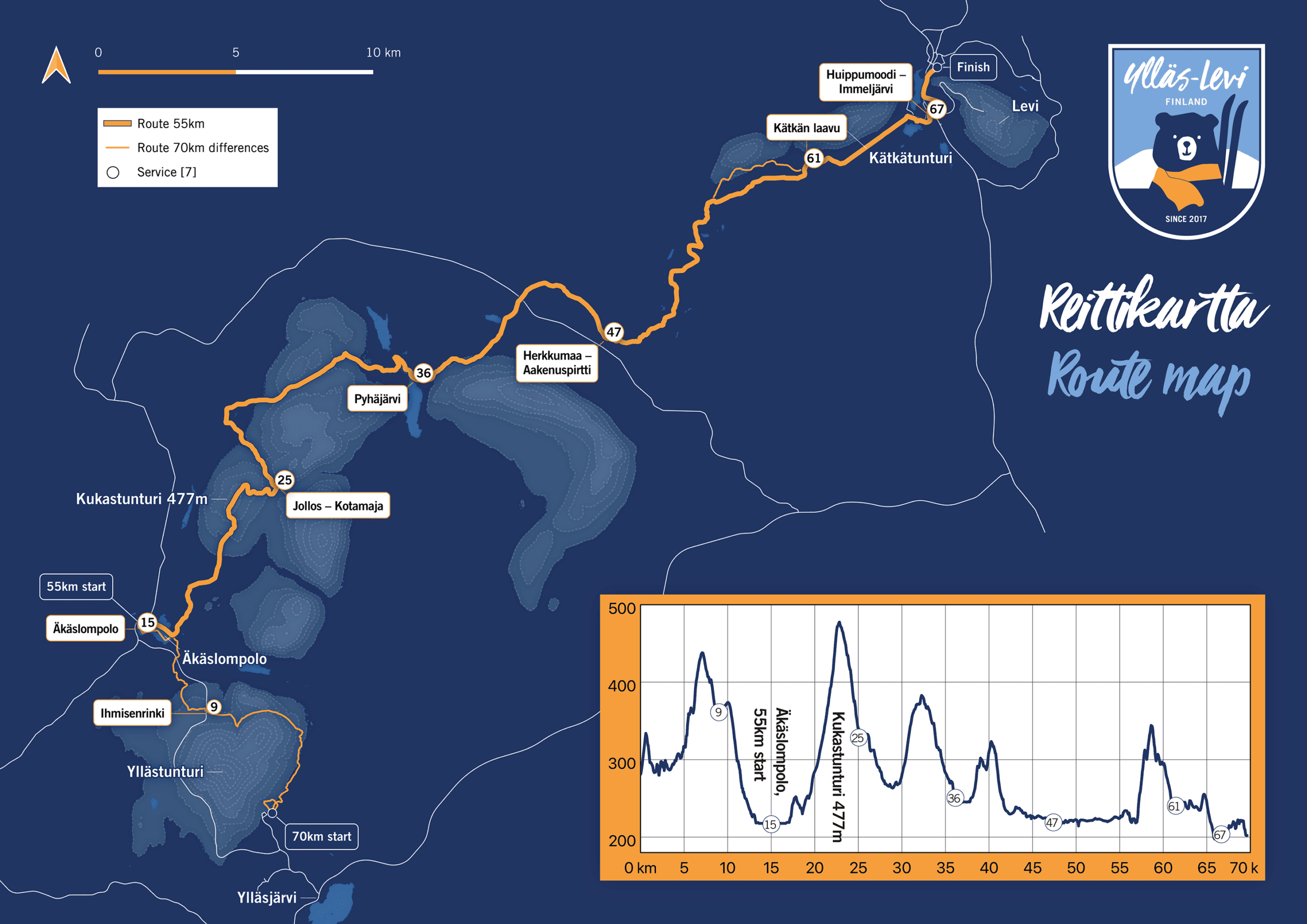
Ylläs-Levi track description
The starting point for the 70km is located on the Ylläsjärvi side of Yllästunturi (Ylläs Ski Resort Ylläsjärvi, address Iso-Ylläksentie 44, Ylläsjärvi).
The start is on flat ground and follows the downhill ski slope uphill, soon descending again near to the starting point. There are a few turns downhill, and as the differences between skiers are not yet long, it is wise to take into account your own speed and that of the skiers around you to avoid any accidents. A few more kilometres are skied in the ski resort area before arriving at the Cafe Kahvikeidas. From here, the route continues uphill for about 150 metres up the Kellostapulinkuru. After the ascent of the gorge, the descent starts again and at 9 km there is the first service point, Ihmisen Rinki. From here the route continues along the famous Isomettä climb – but downhill – for about two kilometres. In fast conditions, the speed on this section can be up to 60km/h. After the descent, you cross the Maisematie and ski towards the village of Äkäslompolo and the Äkäslompolo lake. At this point you have skied 15km and the next service point is on the Äkäslompolo ice, near the school. The 55km starting point is also at the same place.
From Äkäslompolo lake starts the ascent towards Kukastunturi, a total of 4km and more than 200m of ascent. From there, a fast descent begins towards Kotamaja, where there is another service point. From Kotamaja you ski towards Pyhäjärvi, and the terrain varies from flat to hilly. When you reach Pyhäjärvi, you have skied 36km, and you will find the next service point. From Pyhäjärvi, there is another short ascent towards Aakenustunturi and Aakenuspirtti. When you reach Aakenuspirtti, you have skied 47km and there is a service point of Herkkumaa. From Aakenuspirtti the route continues towards Pyhätunturi. This section of the trail has by far the flattest terrain on the route.
Before the Kätkä hut, the last heavy ascent begins. The ascent of Pyhätunturi is about 2km long and 100 metres high. After the ascent of Pyhätunturi there is another steep downhill section and you reach Kätkän laavu, where there is a service point, and you have already skied 61km. The last 9km are Levi trails as you ski the edge of Kätkätunturi and the terrain changes from flat to hilly towards the end of Immeljärvi. Here, the skiers are offered a further boost in the form of Coca Cola and Sammalvaara doughnuts at the Huippumodi service point. From the end of Immeljärvi, ski towards Koutamaa and continue along the scenic route towards the centre of Levi and the finish line at theparty pub V’inkkari yard.
Ylläs-Levi Hiihto 55km track description
The starting point of the 55km ski race is in Äkäslompolo in the western part of the Lake Äkäslompolo, near the school (address: Koulutie 2, Äkäslompolo).
The route follows the 70km route. The 55km route deviates from the 70km route only after Aakenuspirtti, before Kätkän laavu, where the ascent of Pyhätunturi is left unclimbed and the fell is bypassed on its right side.